Fintry is a small village beyond the Campsie Fells, north of Glasgow. At the edge of a low mound near Endrick Water stands a solitary stone, a little under four feet tall.
In the 16th or 17th century a horse and rider was carved on one face, although this is now difficult to distinguish (that is, I couldn't find it at all!).
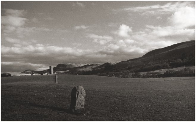
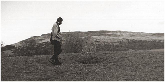
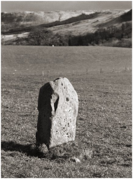
1/11 Looking south-east with the Campsie Fells in the background
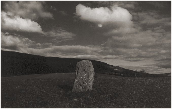
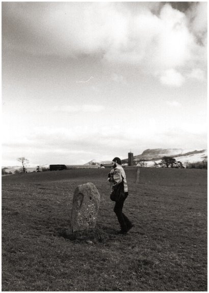
2/11 Looking east
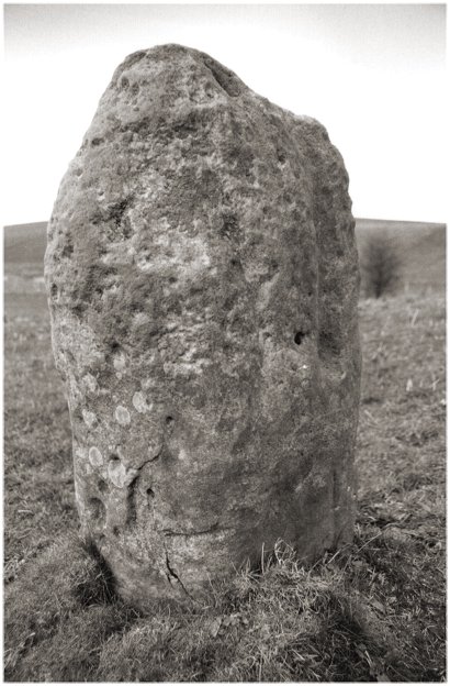
3/11 The stone is certainly cup-marked, but the marks on this face are natural weathering
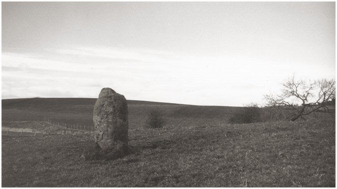
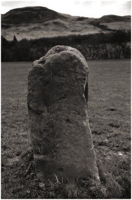
4/11 Looking north-west
5/11 Looking north-east to the Fintry Hills. The yardstick is six feet tall
6/11 The grooves and rough face are natural. The depression on top may be artificial
7/11 Looking south-east
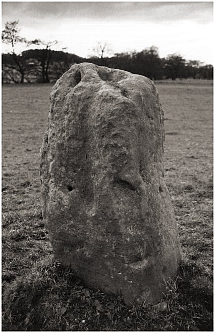
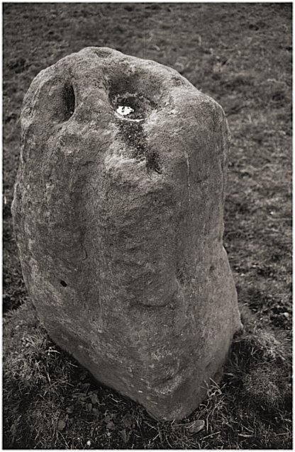
8/11 Much of the pock-marking would seem to be artificial (but not necessarily pre-historic)
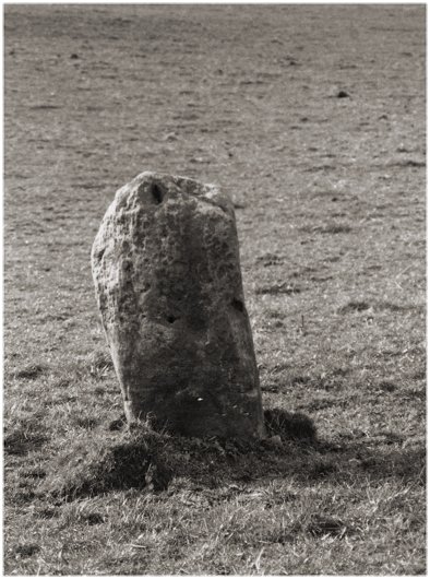
9/11 This face, according to the CANMORE record, was carved with a horse and rider in the medieval period. We couldn't find the carving.
10/11 Looking south
11/11 Looking down onto the bowl-shaped depression
Nearby Sites
6km Waterhead Standing Stones
9km Broadgate Farm Standing Stone
9km Strathblane Parish Church Standing Stone
10km Blanefield Standing Stones; Cairn
11km Auld Wives Lifts Carved Stone; Celtic Heads
13km Craigenkirn Long Cairn? Modern Ruin? A combination?
13km Inchmahome Priory Priory
14km Menteith 16 Cup and Ring Marks
14km Menteith 20 Cup Marks
14km Nether Glenny Cairns Cairn
14km Stockie Muir Chambered Cairn
15km St. Maha's Well Standing Stone; Well
16km Bearsden Bathhouse Roman Fort
16km Whitehill Cup and Ring Marks
16km Garadh Ban Wood Chambered Cairn
17km Doune Castle Castle
19km Doune Standing Stones
(NB: All distances are as-the-crow-flies. Lochs, mountains and beautiful winding roads will make it further. Sometimes much further.)